


West Pleasant Home Precinct, Polk County, Nebraska
About
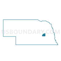
Outline

Summary
| Unique Area Identifier | 613737 |
| Name | West Pleasant Home Precinct |
| County | Polk County |
| State | Nebraska |
| Area (square miles) | 66.85 |
| Land Area (square miles) | 66.76 |
| Water Area (square miles) | 0.09 |
| % of Land Area | 99.86 |
| % of Water Area | 0.14 |
| Latitude of the Internal Point | 41.11177000 |
| Longtitude of the Internal Point | -97.76173160 |
Maps


Graphs
Select a template below for downloading or customizing gragh for West Pleasant Home Precinct, Polk County, Nebraska


Neighbors
Neighoring Voting District (by Name) Neighboring Voting District on the Map
- #7 Precinct, Hamilton County, NE
- Arborville-Bradshaw-Lockridge Precinct, York County, NE
- North Osceola Precinct, Polk County, NE
- Prairie Island Precinct, Merrick County, NE
- South Osceola Precinct, Polk County, NE
- Thayer-Morton Precinct, York County, NE
- West Stromberg Precinct, Polk County, NE
Top 10 Neighboring County Subdivision (by Population) Neighboring County Subdivision on the Map
- South Osceola precinct, Polk County, NE (1,090)
- North Osceola precinct, Polk County, NE (987)
- West Stromsburg precinct, Polk County, NE (750)
- Precinct 7, Hamilton County, NE (605)
- West Pleasant Home precinct, Polk County, NE (604)
- Morton precinct, York County, NE (389)
- Arborville precinct, York County, NE (125)
- Prairie Island township, Merrick County, NE (85)
Top 10 Neighboring Place (by Population) Neighboring Place on the Map
Top 10 Neighboring Unified School District (by Population) Neighboring Unified School District on the Map
- Cross County Community Schools, NE (2,202)
- High Plains Community Schools, NE (1,780)
- Osceola Public Schools, NE (1,612)
Top 10 Neighboring State Legislative District Upper Chamber (by Population) Neighboring State Legislative District Upper Chamber on the Map
Top 10 Neighboring 111th Congressional District (by Population) Neighboring 111th Congressional District on the Map
Top 10 Neighboring Census Tract (by Population) Neighboring Census Tract on the Map
- Census Tract 9601, Polk County, NE (3,239)
- Census Tract 9696, York County, NE (2,711)
- Census Tract 9600, Polk County, NE (2,167)
- Census Tract 9666, Merrick County, NE (1,947)
- Census Tract 9691, Hamilton County, NE (1,934)
Top 10 Neighboring 5-Digit ZIP Code Tabulation Area (by Population) Neighboring 5-Digit ZIP Code Tabulation Area on the Map
- 68666, NE (1,611)
- 68651, NE (1,470)
- 68628, NE (826)
- 68319, NE (552)
- 68654, NE (541)
- 68316, NE (447)
- 68846, NE (296)